In 2013 TLA inventoried over 20 road ends to select a site to build a greenbelt demonstration. A road end is either a 33 or 66 foot wide site where a road ends in a body of water. These sites are public property and are designed so that the public may have access to lakes and streams. Due to the heavy foot traffic that these sites experience they are prone to erosion. The TLA wanted to install a greenbelt at one of these sites to reduce erosion and make the site more enjoyable for the public.
According to the Sensible Shoreline Development Guide presented by the Tip of the Mitt Watershed Council a greenbelt can be defined as “a buffer of native vegetation between the water’s edge and your lawn.” A greenbelt results in slower runoff which reduces erosion and pollution; this in turn protects property values and water quality. By using native vegetation that thrives in the already present environment the need for extra care, such as fertilizing the area is reduced. Because the need for fertilizer is reduced there are fewer pollutants washed into the water. Native vegetation also has deeper roots than grass does which also results in more runoff being absorbed and less fertilizer reaching the water.
Site Evaluation:
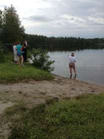
On June 27, 2013 Diane Crandall, of Bloomin’ Buddies, showed the TLA interns how to assess road ends. The interns were given a Shoreline Erosion Assessment sheet and inventoried several sites. The interns had to record information such as the shoreline type, water depth, type and percent of vegetation present, and where there was erosion and how intense it was. After being taught how to complete the assessment the interns where each given three road ends to assess on their own. The interns got together after completing the evaluations and discovered road ends ranged from beautiful parks with boat ramps and swimming beaches to small foot paths that lead down steep bluffs to private property owners that had made the road ends appear to be part of their property.
The Project:
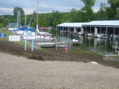
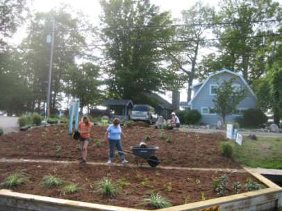
After assessing several road ends we selected Butch’s Tackle and Marine for the demonstration. Right next to the boat ramp there was a little grassy area where erosion was. First a design for the area was drawn up by Diane Crandall, and then the planting began. First all the grass had to be removed. Due to the proximity of the water and steep slope, the grass was removed by hand and tiller.
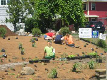
Next a biodegradable erosion blanket made of coconut was laid down to prevent erosion while the plants took root. The interns then proceeded to cut holes into the blanket to plant the plants. The final step was to add mulch and watch the new greenbelt grow.
Future Plans:
If the greenbelt at Butch’s Tackle and Marine does well there is a possibility that it might get expanded. TLA hopes that this project will serve as a demonstration and inspiration to the public and serves as a gateway to further projects.